City Walks – Explore Freising independently
Freising’s “City Walks” take in a range of different destinations and routes through the city. They allow you to explore various themes independently with the help of a city map. Just head off and investigate! The city maps are available in German only.
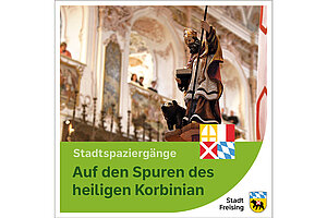

In the footsteps of St Korbinian
The handy fold-out map takes you to the most important places of the bishop in Freising. The main stops are the Domberg, the city centre and the Weihenstephaner Berg. Along this route, you can discover the places where the patron saint of Freising worked as well as legendary places and places of remembrance. Interesting and surprising facts about Bishop Korbinian accompany you on this circular route.
The fold-out map can be found at the Tourist Information Office or downloaded here (only available in German).
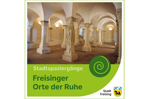

Freising places of rest
In and around Freising there are numerous powerful places from the past and present. Sometimes they are well-known places that you pass by almost without noticing in everyday life, sometimes new spaces that are only now opening up. The city walk invites you to take your time and slow down, consciously come to rest and draw strength.
The fold-out map can be found at the Tourist Information Office or downloaded here (only available in German).
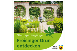

Trough Freisings nature
Natural floodplain forests along the River Isar, historically grown gardens, scientific botany – Freising has a lot to offer in terms of "green". The Freising garden landscape looks back on centuries of history. We invite you to take a walk through Freising's green oases – it goes from the Cathedral Hill Domberg in the historic old city to the modern research location Weihenstephan.
The fold-out map can be found at the Tourist Information Office or downloaded here (only available in German).
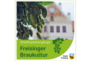

Freising and the Art of Brewing
There is probably nowhere else in the world where the multifaceted art and science of beer brewing is so much a part of life. Here, brewing culture is served by a compact and locally based network; Freising has a unique constellation of beer production, manufacturing and development of brewing technology, raw materials from the nearby Hallertau region and science and teaching on the subjects of brewing, beverages, foods and raw materials. This city walk provides an introduction to the history of beer in Freising. It goes from Cathedral Hill – the ancient heart of brewing under the prince-bishops – to the old quarter and then to Weihenstehan Hill, the innovation-driven 21st century research hub. The tour portrays how Freising is combining the Bavarian beer tradition with the culture of brewing ancient and modern.
The fold-out map can be found at the Tourist Information Office or downloaded here (only available in German).
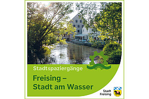

Freising - City on the water
Freising is a city on the water, the rivers and streams have shaped the city for centuries. And every summer the citizens of Freising enjoy the cool paths along the Moosach or Isar. Guests of the city can now leave the well-known tourist trails and explore Freising on new paths next to watercourses. The family-friendly route passes splashing fountains, well houses and former mills. The trail leads to the Isar floodplains, but also to an urban landscape with winding river arms and a very individual character. The inner-city watercourses and the charming green corridors inspire visitors all year round.
The fold-out map can be found at the Tourist Information Office or downloaded here (only available in German).
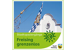

Freising without borders
The aim of this city walk is to explore Freising barrier-free and get to know the city better. The map shows which paths, squares and sights in Freising city centre are easily accessible with a wheelchair, walking aid or pushchair. All destinations are accessible without steps. The route is flat, except for a slope at Marienplatz and a slight incline on the Domberg. Sometimes the path leads over cobblestones. The various stations are also explained in easy language. So that Freising's history is open to everyone.
The fold-out map can be found at the Tourist Information Office or download it here (only available in German).
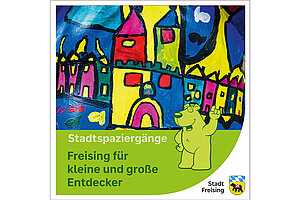

Freising for explorers great and small
The map offers kids and parents – and anyone else! – the opportunity to discover key sights at their own pace, in their own way. As the enticing invitation reads, “Come and join us on a walk through Freising! We’ll see buildings and places that tell us about life in Freising then and now.” The city map covers the historic quarter and Cathedral Hill and suggests a short ten-point tour. The interestingly varied route starts at the Town Hall and Marienplatz and moves to the upper old town, Zierer-Haus, city walls and Bürgerturm tower, Heiliggeistspital, along idyllic Fischergasse and up to the monumental Cathedral Hill. The texts are accompanied by pictures designed to inspire interest in young explorers. The map is aimed at roughly five- to eleven-year-olds. Puzzles and quiz questions attract the kids’ attention along the way. The young “sleuths” and “pros” – older children or parents – have to find the answers at specific locations and can check the correct solutions on the map. To solve these questions, kids will need to take a very close look at the buildings and decorated facades.
The fold-out map can be found at the Tourist Information Office or downloaded here (only available in German).
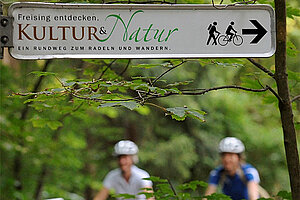

Circular route – Culture and Nature
The 13.5-km circular route takes in the main sights of Freising, including the former abbey church of Sts Peter and Paul in the district of Neustift, Freising’s historic centre with Cathedral Hill, the Wieskirche church, the Schafhof – European Art Forum Upper Bavaria, and Weihenstephan, with the world’s oldest brewery and beautiful show gardens.
A detailed tour map is available from the Tourist Information Office.